Research News
A CROSS-CORRELATION PHENOLOGY-BASED CROP FIELDS CLASSIFICATION USING SENTINEL-2 TIME SERIES
(by Simone Saquella, Giovanni Laneve e Alvise Ferrari)
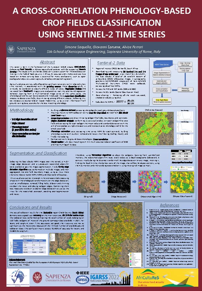 Agricultural Areas are naturally affected by significant variations within relatively short time intervals, in accrodance with the growing season. These dynamics could, in principle, be exploited to classify different types of crops. Vegetation indices retrieved from Sentinel-2 imagery are evaluated to track the year-round vefetation behaviour.
Startting from a multi-temporal image series of the same scene, the phenological profiles can be extracted and introduced into a supervised classification process to detect crop fields, discriminating among different species. Following this, it was proposed a cross-correlation based model that, using a priori information from ground training data, seraches for the best matching phenology.
EVALUATING SENTINEL-3 VIABILITY FOR VEGETATION CANOPY MONITORING AND FUEL MOISTURE CONTENT ESTIMATION
(by Valerio Pampanoni, Giovanni Laneve e Giancarlo Santilli)
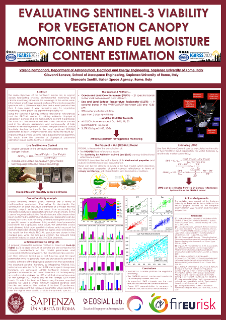 The main objectives of the Sentinel-3 mission are to support ocean forecasting systems, environmental monitoring and climate monitoring. However, the coverage of the visible, near-infrared and short-wave infrared portion of the electromagnetic spectrum with a 300 meter resolution and a revisit period of less than 2 days make it very appealing also for vegetation monitoring, In this work, we explore the possibility of using the Sentinel-3 Synery surface directional reflectances and the PROSAIL model to reliably estimate biophysical variables in general and live fuel moisture content in particular.
A FULLY AUTOMATIC METHOD FOR ON-ORBIT SHARPNESS ASSESSMENT. A CASE STUDY USING HYPERSPECTRAL SATELLITE IMAGES
(by Valerio Pampanoni, Luca Cenci, Giovanni Laneve, Carla Santella, e Valentina Boccia)
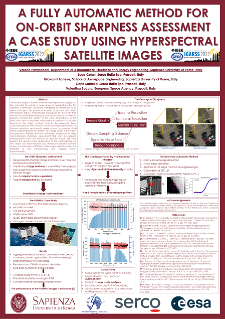 The recent surge in interest towards hyperspectral imagery has the potential to unlock a new range of applications for the scientific community. However, compared to traditional multi-spectral images, the workload required to process such high-dimensional data is dramatically increased, to the point tha new and more flexible stratefies must be developed in order to properly monitor the quality of this tupe of products. In the particular case of sharpness assessment, tradictional procedures based on the edge method tend to be extremely time-consuming due to their reliance on visual analysis performerd by human operators, and would make proper processing of all bands a daunting task to perform on a large scale. In this paper we propose a flexible and fully automatic approach to edge method-based sharpness assessment than can be applied independently from the number of spectral bands.
L'INGEGNO ITALIANO ALLA CONQUISTA DELLO SPAZIO
(by Roberto Della Ceca e Frida Paolella)
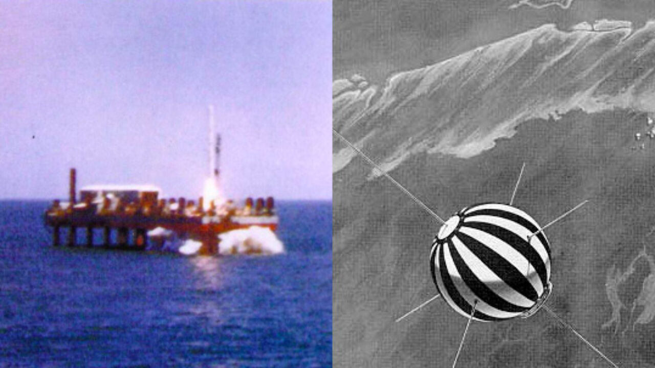 53 anni fa il lancio del satellite San Marco 2:
Il 26 aprile 1967, alle ore 10:04 Utc, sotto gli occhi stupiti di chi dalla spiaggia osservava i preparativi, si alzò in volo dalla base italiana di lancio al largo di Malindi – in pieno oceano, unica al mondo – il satellite San Marco 2. Roberto Della Ceca e Frida Paolella ripercorrono le fasi principali di quell’evento, interamente – tranne il vettore Scout messo a disposizione dagli Stati Uniti – opera italiana